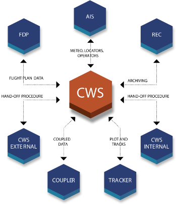
ALS CWS / Ground CWS
ALS system Controller Working Position display module.
ALS CWS / Ground CWS provides controllers with a clearly structured display of the air traffic/ground situation integrating the surveillance data and the flight data. The position data are received from the tracker and displayed in the main and the secondary radar window, together with other aircraft information on a background of colour maps of Area of Interest (AoI). The flight plans are received from Flight Data Processing System (FDPS) and displayed as fully customizable electronic strips. ALS CWS automatically matches the flight plans to the tracks.